Bran Sands

Commercial | Redcar

Bran Sands Water Treatment Works Project

In July 2024, NTB Survey was commissioned by Betts Associates to carry out a comprehensive topographical survey at Bran Sands Water Treatment Works near Redcar, on behalf of Northumbrian Water. The primary purpose of the survey was to support a site-wide bund containment assessment, ensuring the facility complied with current environmental containment standards and informing any future upgrades to bunding infrastructure. The survey formed a critical part of Northumbrian Water’s broader asset management and planning strategy.

Project Scope

The survey area, measuring 70m by 50m, included two large sludge tanks, outbuildings, bunds, pipework, drainage features and changing ground surfaces. Betts Associates required detailed records of structures, levels, materials, pipe layouts and drainage connections. Because of the site’s complexity, particularly the raised pipework in relation to nearby buildings, a 3D topographical survey was essential to support both design review and future site planning.

What We Did

To capture the site accurately, we used a Leica laser scanner to create a full 3D model. This method was efficient and precise, especially for the complex pipework, tanks and bunds. A survey control network was set up to ensure accuracy and multiple scanning positions were used to record all surfaces and structures. Manholes were inspected where safe, with drainage details noted. The scans were combined into a single dataset, which was then used to produce a detailed 3D topographical drawing for design and planning. This offers a safer and more thorough alternative to traditional methods and avoids the need for time-consuming revisits.

CHALLENGES FACED & DELIVERABLES

The survey faced several challenges, including a complex network of overlapping pipework that required extra scanning and careful CAD interpretation. Accessing manholes was also difficult, as some were seized or located in restricted zones, meaning we had to rely on surface clues to infer drainage details. Working on a live treatment site required close coordination with Northumbrian Water to avoid disruption and follow strict safety rules, using long-range scanning where needed. An unexpected crane arrival added further delays, requiring extra precautions and careful scheduling to keep the work running safely and smoothly.

We Delivered:

A fully detailed 3D topographical drawing and a ‘flattened’ 2D drawing, both issued in DWG format. These included:

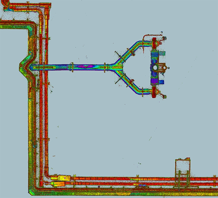
Fully annotated levels and contours

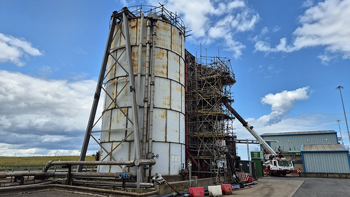
Accurate representation of tanks, bunds and outbuildings

Pipework shown with correct heights and alignments

Drainage infrastructure with cover levels, types and invert data where available

Surface materials and joint boundaries clearly defined

PDF Hover-Zoom + Smooth Pan (Fixed Zoom Level)

Feedback & life after working with us

Feedback from Betts Associates was very positive, with no amendments requested. The outputs were passed to Northumbrian Water’s engineering and asset planning teams for use in current and future infrastructure reviews.

This project at Bran Sands Water Treatment Works demonstrated the value of applying laser scanning and pointcloud-based drafting techniques to complex utility environments. The high level of accuracy and spatial surety required was achieved efficiently, with minimal site disruption and maximum data reliability.

The survey outputs provided Betts Associates and Northumbrian Water with the robust foundation they needed to assess containment capacity, plan for improvements and ensure compliance with bunding and drainage regulations.