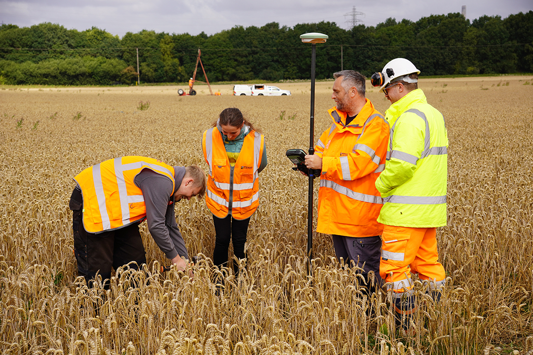
TOPOGRAPHIC SURVEYS

LEARN MORE ABOUT NTB SURVEY SERVICES

TOP-QUALITY TOPOGRAPHICAL SURVEYS DELIVERED BY PROFESSIONALS

Understanding the lay of the land for development projects that satisfy planning conditions, requires an accurate and comprehensive topographical survey.

Our expert surveyors offer a UK-wide service, which they tailor to suit your specific requirements with precision.

Every detail of your site is captured, from natural features to man-made structures, with accuracy and within your given deadline.

WHAT IS A TOPOGRAPHICAL SURVEY?

A TOPOGRAPHICAL SURVEY (ALSO KNOWN AS A ‘TOPO SURVEY’ OR ‘TOPOGRAPHIC LAND SURVEY’) IS A DETAILED MAPPING OF THE SURFACE FEATURES OF A PLOT OF LAND. BOTH NATURAL AND ARTIFICIAL FEATURES, AS WELL AS CHANGES IN ELEVATION, ARE REPRESENTED ON THE RESULTING PLAN.

A ‘TOPO’ USUALLY INCLUDES INFORMATION ABOUT:

MAN-MADE FEATURES

Any new development must respect pre-existing structures and features. Our experienced surveyors will chart everything from buildings to shed, and railways to roads so that your project can blend seamlessly with the existing lay of the land.

NATURAL FEATURES

From bodies of water to forests, areas of significance, and more, a topographical survey captures an accurate map of everything Mother Nature has blessed your site with.

TERRAIN

By meticulously denoting the natural contours, elevations, valleys, slopes, and depressions of a site, our experts capture the unique fingerprint of the land. This critical information can be leveraged to underpin any project so that it complements the landscape.

THE PURPOSE AND APPLICATION OF A TOPOGRAPHICAL SURVEY

A ‘TOPOGRAPHICAL LAND SURVEY’ CAN BE USED FOR:

LAND SALES

For anyone looking to buy or sell land, knowledge is power. A professional topographical survey offers a detailed insight to the land’s potential and constraints, therefore enabling a more transparent marketplace.

DEVELOPMENT PROJECTS

Topographical surveys ensure that every subsequent decision in a development project is well-informed and strategic to yield optimal results. It offers an accurate representation of the land and highlights potential opportunities and challenges. Simultaneously, it is a great way to ensure the prospective development adheres to planning conditions.

WHY CHOOSE NTB SURVEY FOR TOPOGRAPHICAL SURVEYS?

WITH OUR SEASONED EXPERTS WIELDING THE LATEST TOOLS OF THE TRADE, OUR METICULOUSLY DETAILED TOPOGRAPHICAL LAND SURVEYS OFFER DEEP INSIGHT INTO YOUR PROJECT SITE. WE UNDERSTAND THE IMPORTANCE OF TAKING ACCURATE MEASUREMENTS OF EVERY NATURAL AND MAN-MADE FEATURE. THE PRECISION WITH WHICH WE CAPTURE EVERY DETAIL IS TESTIMONY TO THE RESPECT AND CARE WE HAVE FOR EACH PROJECT WE WORK ON.

EXPERT TEAM

With decades of combined experience, our expert land surveyors will apply their knowledge to help you better understand your site’s terrain.

TOP-QUALITY TECHNOLOGY

We stay ahead of the curve by investing in the latest surveying technology to speed up the process and improve the accuracy of our surveys.

BESPOKE SERVICE

We adapt to deliver optimal results against your specific requirements, taking the time to understand the unique challenges of each building.

UK-WIDE SERVICE

No matter where you or your project is based, we will ensure one of our seasoned experts is on hand to deliver a consistent and top-quality service.

READY TO GET STARTED?

THE NTB SURVEY PROMISE

BEYOND DELIVERING A HIGH QUALITY SERVICE USING THE LATEST TOOLS AND TECHNIQUES, OUR CORE VALUES ARE ROOTED IN DELIVERING AN EXCELLENT CUSTOMER EXPERIENCE, DEVISING INNOVATIVE SOLUTIONS, AND LETTING THE QUALITY AND RELIABILITY OF OUR WORK SPEAK FOR ITSELF.

COMPREHENSIVE SOLUTIONS

We go the extra mile to ensure a top-quality, integrative solution, which examines the wider picture. From employing the latest technology to bespoke solutions, to considering our environmental impact at each stage, we breathe excellence into each client experience.

CLIENT-CENTRIC APPROACH

Our knowledgeable surveyors place the client at the centre of the decision making process and take time to fully understand the unique requirements of their project.

WHAT HAPPENS DURING A TOPOGRAPHICAL SURVEY?

We take a tried-and-tested, systematic approach when surveying any building, to ensure we accurately capture the full picture.

When you book a survey with us, we will start with an initial consultation to fully understand your needs, as well as the specific challenges posed by the site. This creates the opportunity for a conversation about your vision for the site, any concerns, and to ensure our services align with your requirements.

On arrival at the site, your dedicated surveyor will leverage our state-of-the-art equipment to gather a comprehensive dataset with which to best understand the natural terrain and any man-made structures.

After carrying out the topographical survey, the raw data will be churned into actionable insights. This means the data is already processed and formatted into easy-to-understand chunks that you can use to inform your project.

Depending on your needs, we can prepare detailed topographical maps and more. Each document is carefully drafted to give you the deepest understanding of your site’s terrain and features.

FREQUENTLY ASKED QUESTIONS ABOUT TOPOGRAPHICAL SURVEYS

WHAT IS A TOPOGRAPHICAL SURVEY?

A topographical survey (also known as a ‘topo survey’ or ‘topographic land survey’) is a detailed mapping of the surface features of a land site. Both natural and artificial features, as well as changes in elevation, are represented on the resulting three-dimensional plan.

No. Providing our surveyors have access to the area required to be surveyed, we need neither presence by the owner nor assistance. All data to be captured can be picked up either by the surveyor themselves or by leveraging reflectorless technology.

The duration of a topographical survey primarily depends on the size and complexities of a site. While a smaller plot may take a day or two, larger sites might take several days or weeks. This is usually discussed in the initial consultation.

A topographical survey specifically examines a plot of land’s physical features, whereas measured building surveys observe the internal space and external features of a building. Equally a boundary survey utilises topographic survey techniques to define land extents in comparison to its surroundings, often incorporating Ordnance Survey data for submission to Land Registry.

Aside from creating a detailed map of your plot’s natural and man-made features, a topographical survey can also support:

Property sales by providing estate agents and prospective buyers with a detailed and transparent plan of the site’s features.

Planning and development by producing essential information to ensure each project meets planning conditions.

Renovation projects by helping project managers understand the existing condition of the, prior to commencing works, which helps to inform plans and better mitigate potential risks.

LAND SURVEY SERVICES

OFFERING A RANGE OF SURVEYING SERVICES FOR PROJECTS OF ALL SIZES, AT COMPETITIVE RATES, COVERING THE WHOLE OF THE UK.

TOPOGRAPHIC SURVEYS

MEASURED BUILDING SURVEYS

SETTLEMENT MONITORING

CUT-FILL ANALYSIS & VOLUME CALCULATIONS

UTILITY SURVEYS

DRONE SURVEYS

TREE SURVEYS