TREE SURVEYS

LEARN MORE ABOUT NTB SURVEY SERVICES

RELIABLE AND ACCURATE TREE SURVEYS

British Standard 5837:2012: Tree Surveys, Arboricultural Impact Assessments, and Arboricultural Method Statements.

British Standard 5837:2012 provides essential guidelines for the management and protection of trees during development projects, from private residential extensions to large-scale housing developments. This standard sets the framework for assessing trees that may be affected by construction activities, ensuring that the environmental and amenity value they provide is preserved, while allowing for sustainable development.

TREE SURVEYS

Tree surveys are fundamental to the planning process and must be carried out by qualified professionals.

A THOROUGH TREE SURVEY INCLUDES:

TREE IDENTIFICATION:

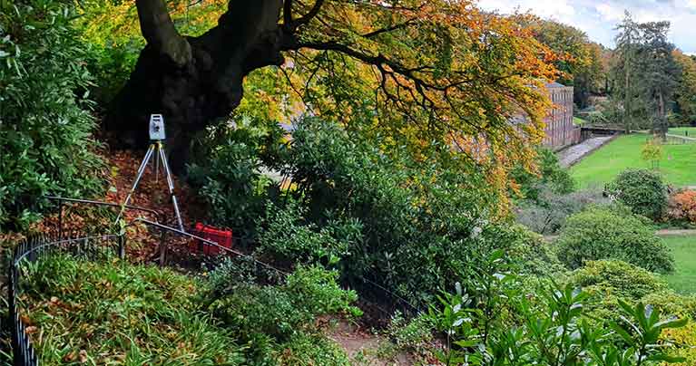
Accurate records of species, age, height, crown dimensions, and trunk diameter.

HEALTH ASSESSMENT:

Evaluation of each tree’s physiological condition and structural integrity.

RETENTION VALUE:

Classification of trees based on BS 5837:2012 categories, highlighting those with the highest value for retention.

ARBORICULTURAL IMPACT ASSESSMENTS (AIA)

The arboricultural impact assessment evaluates how the proposed development may affect the existing trees and involves:

IDENTIFICATION OF CONSTRAINTS

Using the tree survey data, a tree constraints plan is developed, accurately showing the position of each tree, its root protection area, and canopy spread. This plan guides the design process by highlighting how retained trees may influence the development layout.

EVALUATION OF IMPACTS

Proposed designs are overlaid onto the tree constraints plan to assess potential direct impacts, such as root damage or canopy pruning, and indirect impacts like shading.

MITIGATION STRATEGIES

Strategies are developed to minimize any adverse effects on trees, such as adjusting building footprints, re-routing services, or proposing the relocation of structures. This section also outlines any trees to be removed and includes plans for mitigation planting.

ARBORICULTURAL METHOD STATEMENTS (AMS)

Once designs are finalised, an arboricultural method statement outlines how the retained trees will be protected during construction. This document is often a key requirement for securing planning permission and includes:

TREE REMOVAL PLANS

Detailed diagrams showing trees to be removed, retained, and any pruning required.

TREE PROTECTION PLANS

Clear illustrations of protective barriers, restricted access zones, and other mitigation measures to ensure tree safety throughout the construction process.

MONITORING PROTOCOLS

Procedures for ongoing monitoring during construction to address any unforeseen impacts on the retained trees.

COMPLIANCE AND BEST PRACTICES

Adhering to bs 5837:2012 is not just about regulatory compliance but is also a commitment to sustainable development. By incorporating tree conservation into the design process, developments can enhance biodiversity, improve air quality, and create attractive, green environments that benefit both current and future generations. Collaboration between architects, developers, and arboriculturists is key to achieving a balanced, sustainable land use.

READY TO GET STARTED?

WHY CHOOSE NTB SURVEY LTD?

At NTB Survey Ltd, our expert team of tree surveyors conducts thorough and professional tree surveys in line with BS 5837:2012, providing you with all the data required for a successful development.

We work closely with architects and developers to integrate tree protection into the planning process, producing high-quality Arboricultural Impact Assessments (AIA) and Arboricultural Method Statements (AMS) that satisfy local planning authorities. Our reports are designed to demonstrate your commitment to environmental stewardship, helping to smooth the planning process and remove potential obstacles.

With NTB Survey Ltd, you can be confident that your development will meet the highest standards of tree conservation, ensuring both compliance and sustainability.

LAND SURVEY SERVICES

OFFERING A RANGE OF SURVEYING SERVICES FOR PROJECTS OF ALL SIZES, AT COMPETITIVE RATES, COVERING THE WHOLE OF THE UK.

Topographic Surveys

A topographic survey is basically a detailed map of your land. We measure and record everything on your property such as building footprints, roads, trees, ground height and property boundaries.

Measured Building Surveys

A measured building survey captures the precise dimensions and layout of a building’s structure, external facade and internal features.

Setting Out Engineering

Setting out is taking your building position from a design drawing and marking out exactly where everything goes on the actual ground. It’s like creating a life-size version of your drawings.

Settlement Monitoring

Settlement monitoring is keeping track of whether buildings, land or structures are moving or sinking over time. We use precise equipment to measure tiny movements.

Boundary Surveys

A boundary survey is finding out exactly where your property lines are and creating an accurate map of them. It shows where your land legally starts and ends.

Cut-fill Analysis & Volume Calculations

Calculate accurate volumes for earthworks, stockpiles, and other land features to support construction projects.

Drone Surveys

Offering a quick, efficient and affordable way to get an aerial survey, resulting in high-quality photographic and video data.

Utility Surveys

Identify and map underground utilities such as gas, water, sewer, and electrical lines to prevent conflicts and ensure safety during construction and excavation activities to PAS128 Standards.

Tree Surveys

British Standard 5837:2012: Tree Surveys, Arboricultural Impact Assessments, and Arboricultural Method Statements.